
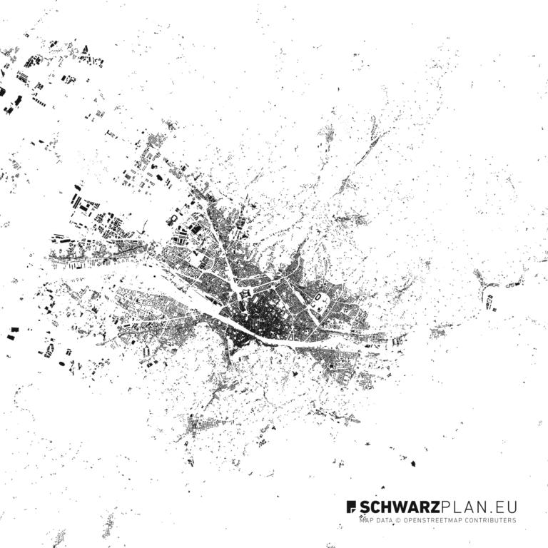
Create a Figure-Ground Plan
Three routes to a figure-ground plan: free geodata, drawing it yourself in QGIS – or downloading it finished and true to scale as a vector file in seconds.
Three Ways
Which way suits you?
Free
Geodata & Outlines
Download free city outlines as SVG and GeoJSON and assemble your figure-ground plan yourself.
To the geodata tool →Draw It Yourself
QGIS & OpenStreetMap
Full control: filter the building data, choose the extent, colour the building footprints and export. Guide below.
To the guide →Buy Ready-Made
Instant & true-to-scale
No GIS skills needed: choose city and format, download a print-ready vector figure-ground plan instantly.
To the shop →
Data source
Where the building data comes from
A figure-ground plan is only as accurate as its source. Three are available for German cities — the cadastre is the more accurate one, OpenStreetMap the faster one.
| Source | Coverage and quality | License | Effort |
|---|---|---|---|
| OpenStreetMap | Available worldwide. Outlines are usually positioned correctly, but the level of detail varies from region to region with how thoroughly it has been mapped. | ODbL. Attribution is mandatory. A derived database has to be released under ODbL again; a map drawn from it does not. | Low — ready-made extracts from Geofabrik, targeted queries via Overpass. |
| Official land register (cadastre) | Complete coverage within its country and the most accurate basis for building footprints, because it comes from cadastral surveying. | In Germany this is governed state by state, mostly under Datenlizenz Deutschland (dl-de/by-2-0 or zero-2-0). The required attribution notice is listed for every state in our cadastral map. | Medium — the responsible authority, the portal and the file format differ from state to state. |
| Aerial or satellite imagery | Available even where no vector data exists — accuracy depends on resolution and viewing angle. | Depends on the provider and is often restricted. Check before publishing. | High — a raster image contains no outlines. They have to be traced by hand or extracted by segmentation. |
Which state authority is responsible for your federal state, and the licence its data carries, is listed for every state in the cadastral map.
Guide
Create a Figure-Ground Plan Yourself – in 4 Steps
-
01
Get the geodata
Building outlines come either from the official cadastre or from OpenStreetMap. OSM data is available as a ready-made regional extract from Geofabrik or through targeted Overpass API queries; our outlines are provided as SVG and GeoJSON.
-
02
Filter out the buildings
Load the file into QGIS and filter the building polygons — for OSM data use the expression "building" IS NOT NULL. Then actually clip the extent (Vector → Geoprocessing → Clip) instead of merely panning the view: otherwise the export takes the whole region with it.
-
03
Separating built from unbuilt
Simple fill, black, stroke off. The stroke is the most common mistake: a hairline around every building makes dense quarters print grey instead of black. The ground stays white — a figure-ground plan needs nothing more.
-
04
Set the scale and export
Enter the scale explicitly in the print layout instead of guessing at the zoom: 1:5000 to 1:10000 for city extents, 1:2000 for quarters. Exporting as SVG or PDF keeps the plan vectorial — drop shadows and blend modes, by contrast, force QGIS to rasterise the layer.
Too little time for the GIS work? Ready-made figure-ground plans are available as an instant download.
FAQ
Frequently Asked Questions about the Figure-Ground Plan
What is a black plan?
Can I create a figure-ground plan for free?
Is there a figure-ground plan generator?
In what format do I get the figure-ground plan?
Can I create a site plan for a building application myself?
What scale makes sense for a figure-ground plan?
More in the Catalogue
- All Site Plans & Figure-Ground Plans Shop
- Bundles & Country Packs Save
- Free Geodata & Outlines Free Tool
- Site Plan for the Building Application – Guide Guide
- City map as a vector file – PDF, DWG & DXF Guide
- Download a Figure Ground Plan as a Vector PDF Download
- Site plan – basics, scale & formats Guide
Countries & Regions