
Reading a German development plan — GRZ, GFZ, building limits and what applies without one

Whether three storeys are permitted on a plot or one is recorded neither in the land register nor in the cadastral map, but in the Bebauungsplan — the binding land-use plan. It is a municipal by-law, carries the force of law, and consists of two parts that have to be read together. Looking only at the drawing means missing half of it.
At a glance
- The plan has a drawing (part A) and written provisions (part B) — both are binding.
- Anyone may inspect it, without demonstrating an interest. Usually online in the municipal geoportal.
- GRZ governs how much of the plot may be built on, GFZ how much floor area in total.
- Where no plan applies, § 34 of the Building Code decides — whether a project fits into its surroundings.
Where to find it
Binding land-use plans are public. Unlike the land register, no legitimate interest has to be shown. Three routes lead there:
- The geoportal of the municipality or district. Most councils now publish their plans in force as PDFs, often in a map viewer showing the outlines of each plan area.
- State portals. Several federal states aggregate municipal plans — useful where the municipality itself publishes nothing online.
- The building authority. Inspection on site is always possible; copies carry a fee.
To search a portal at all you generally need the parcel identifier or the address. How to obtain the identifier is covered in finding a parcel and reading the cadastral map.
The two parts
Part A, the drawing, shows the plan area and everything that can be fixed graphically: land-use categories, building lines and limits, traffic areas, green space, easements. The symbols follow the federal Planzeichenverordnung and are therefore identical nationwide.
Part B, the written provisions, carries everything that draws badly — roof forms and pitches, materials, parking ratios, planting obligations, rules for ancillary structures. This is regularly where the provisions sit that actually break a design. Reading the drawing alone reliably misleads.
Alongside comes the explanatory statement. It is not binding, but it sets out what the municipality intended — and that is exactly what helps later when applying for an exemption.
The abbreviations that matter
| Code | Meaning | What it governs |
|---|---|---|
| WA / WR / WS | General / purely / small-settlement residential area | Which uses are permitted |
| MI / MU / MK | Mixed / urban / core area | Mix of housing and commerce |
| GE / GI | Commercial / industrial area | Commercial use, permissible nuisance level |
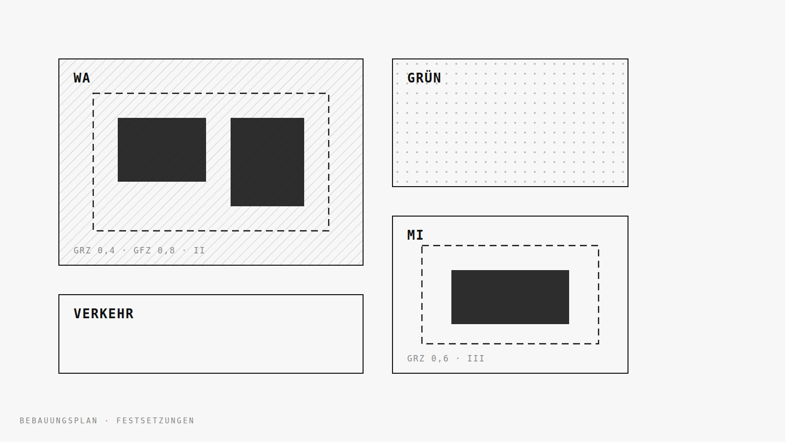
| GRZ | Site occupancy index | Share of the plot that may be built on (0.4 = 40 %) |
| GFZ | Floor area ratio | Gross floor area relative to plot area |
| BMZ | Building mass index | Volume per square metre of plot, mainly in commercial areas |
| I, II, III | Number of full storeys | As a maximum or a minimum |
| o / g / a / E | Open / closed / deviating / detached | Building typology |
| FH / TH / OK | Ridge / eaves / upper edge height | Height limits, usually above sea level |
A common trap is the GRZ: the footprint of the building is not the whole story. Garages, parking spaces and access drives may exceed the GRZ by up to 50 per cent under § 19 (4) BauNVO — but only where the plan does not provide otherwise.
Building limit, building line, building envelope
- Building limit (Baugrenze, dashed blue) — you may build up to this line, but need not. Overstepping only marginally, and only where the plan allows.
- Building line (Baulinie, solid blue) — you must build on this line. Setting back is not permitted.
- Building envelope (Baufenster) — the area enclosed by building limits. Not a legal term, but the everyday one in practice.
When there is no plan
Large parts of established towns are not covered by a binding plan. There § 34 BauGB applies: a project is permissible if, in the type and extent of use, building typology and built area, it fits into the character of its immediate surroundings.
That is not a free pass but an evidentiary task: you have to show how the surroundings are actually built. Which is exactly what context drawings are for — figure-ground plans for grain and density, site plans for building lines and plot patterns. A cleanly drawn context plan carries a preliminary enquiry further than any description.
Outside contiguously built-up areas, § 35 BauGB governs — the outlying area, where in principle only privileged projects are permissible.
Access All Plans
Show the context, don’t describe it.
Figure-ground and site plans for hundreds of cities — PDF, DXF and DWG with separated layers. A full year of access to the entire archive.
View Access All Plans 99 €Frequently asked
May I inspect a plan without giving a reason?
Yes. It is a public by-law; inspection is open to anyone without demonstrating a legitimate interest. That distinguishes it from the land register.
How does it differ from the preparatory land-use plan?
The preparatory plan (Flächennutzungsplan) sets out intended development for the whole municipality and binds only the authorities. The binding plan is parcel-specific, legally binding and the basis for planning permission.
Can provisions be departed from?
Through an exemption under § 31 (2) BauGB — where the basic concept of the plan is not affected and one of the grounds listed there applies. The explanatory statement helps in judging what belongs to that basic concept.
How old can a plan be?
It remains in force until amended or repealed — plans from the 1960s are still valid in many places. Older plans refer to earlier versions of the land-use ordinance; which version applies follows from the date the by-law was adopted and is usually stated in the written provisions.