
German zoning plans: how to find the plan for your property
Which state portal holds zoning plans, how many are actually there – and what applies when no plan exists for your property. All 16 German states with direct links and dates.
Definition
What is a Bebauungsplan (zoning plan)?
A Bebauungsplan is the binding land-use plan of a German municipality under §§ 8–10 BauGB. The municipality adopts it as a by-law, so it is local statutory law. It sets out plot by plot what may be built on a property: type and degree of use, buildable areas, building method and traffic areas. In everyday use it is shortened to B-Plan.
Bebauungsplan (B-Plan) – binding zoning plan
Binding and plot-precise. Adopted as a by-law, so it is directly applicable law. For any single property it shows what is permitted. It is the basis of the building permit.
Flächennutzungsplan (FNP) – preparatory land-use plan
Preparatory and covering the whole municipal area, but not plot-precise. It binds only the authorities, not the builder, and on its own grants no right to build. The Bebauungsplan is developed from it.
Together the two are called Bauleitpläne. If you want to know whether you may build, you need the Bebauungsplan – the Flächennutzungsplan says nothing binding about it.
Contents
What does a zoning plan contain?
A zoning plan consists of the plan drawing, the written stipulations and the explanatory statement. The stipulations under § 9 BauGB govern four things: which use is permitted, how much may be built, where on the property it may be built and in what manner. Everything else – green spaces, parking, planting requirements – is added to that.
The key stipulations
| Stipulation | What it governs | Example on a 500 m² plot |
|---|---|---|
| GRZ – site occupancy index | What share of the plot may be built over. | GRZ 0.4 → 200 m² of buildable ground area. |
| GFZ – floor area ratio | How much floor area may be created in total, across all full storeys. | GFZ 0.8 → 400 m² of floor area in total. |
| Building envelope (Baugrenze, Baulinie) | Where on the plot building is allowed. At a Baugrenze you may build up to the line; at a Baulinie you must build on it. | The area between the building lines, independent of the GRZ. |
| Number of full storeys (Z) | How high you may build, either as a maximum or as a mandatory figure. | II means at most two full storeys, written in Roman numerals. |
| Type of building use | Which use is permitted – residential, commercial, mixed. Given as an abbreviation under the BauNVO. | WA stands for a general residential area. |
GRZ and GFZ together define the degree of building use. A worked example: on a 500 m² plot with a GRZ of 0.4 you may build over 200 m². With a GFZ of 0.8 that means 400 m² of floor area in total – roughly two full storeys on the buildable area. Which values apply to your plot is stated in the zoning plan alone; for the site plan for a building application they are the governing input.
Reading the plan symbols: the use template
The plan symbols are standardised nationwide in the Planzeichenverordnung (PlanZV). The key to reading a plan is the Nutzungsschablone: a small box in the drawing that summarises the main values for a building area – type of use at the top, below it the number of storeys, GRZ, GFZ and building method. Once you can read it, you know a plot's key figures in seconds.
The abbreviations for the type of use come from the PlanZV, the corresponding official designation from the Baunutzungsverordnung (BauNVO):
| Abbreviation | Official designation | BauNVO |
|---|---|---|
| WS | Small housing estate area | § 2 |
| WR | Exclusively residential area | § 3 |
| WA | General residential area | § 4 |
| WB | Special residential area | § 4a |
| MD | Village area | § 5 |
| MDW | Rural residential area | § 5a |
| MI | Mixed-use area | § 6 |
| MU | Urban area | § 6a |
| MK | Central area | § 7 |
| GE | Commercial area | § 8 |
| GI | Industrial area | § 9 |
| SO | Special area – recreation (§ 10) or other (§ 11) | §§ 10, 11 |
Common mix-ups: WB is the special residential area under § 4a BauNVO, not a “residential and office area”. MU is the urban area introduced in 2017 under § 6a, not a variant of the mixed-use area. And SO is not one single type – § 10 covers special areas for recreation, § 11 all others.
All 16 German states
Viewing zoning plans online
The municipality is always responsible, not the state. State portals only aggregate what the municipalities report to them – in most cases voluntarily. The route is the same everywhere: open the portal, search by address or parcel, click the plan area, open the plan and its explanatory statement as PDF.
Important
We do not supply zoning plans – neither as a download nor as a map. Zoning plans are available only from the municipality and through the official portals listed below. This page explains how to get there and what to expect on the way.
| Federal state | Plans in force | Portal | Structured stipulations | DiPlanPortal | As of |
|---|---|---|---|---|---|
| Baden-Württemberg | n/a The state service holds 31,537 plan objects but does not distinguish legal status and ignores every filter – unusable as a count of plans in force. XPlanGML 6.0 is available but contains plan areas only. | Geoportal Raumordnung Baden-Württemberg | no | no | 08/2026 |
| Bayern | n/a State-wide there is only an image service showing plan areas, no queryable vector service. GDI Bavaria reports around 97,000 land-use plans – a figure that counts zoning and preparatory plans together. | Zentrales Landesportal Bauleitplanung Bayern | no | migrating | 08/2026 |
| Berlin | approx. 3,000 An order of magnitude taken from prose published by the Senate Department, not a counted value. The geodata viewer was unavailable for maintenance when checked, so the link points to the departmental page instead. | Senatsverwaltung – Bebauungsplanverfahren in Berlin | no | yes | 12/2024 |
| Brandenburg | 6,748 Our own query against the state service, filtered to legally effective plans in Brandenburg municipalities. The metadata state completeness as 95%. | Geoportal Brandenburg – Bebauungspläne | no | migrating | 08/2026 |
| Bremen | 1,484 City of Bremen, excluding Bremerhaven. Structured stipulations exist for only around 400 plans – those added since the switch to XPlanung. | Bauleitplan-Informationssystem Bremen | partly | yes | 06/2026 |
| Hamburg | 3,046 Adopted plans, including older Baustufen and Durchführung plans. Hamburg is the only state that delivers its entire stock with stipulations in machine-readable form. | Geoportal Hamburg – Bebauungspläne | yes | yes | 08/2026 |
| Hessen | n/a The state portal points to the municipalities rather than holding plans itself, and in any case only covers plans since the 2017 BauGB amendment. There is no state-wide dataset. | Bauleitplanung Hessen | no | no | 08/2026 |
| Mecklenburg-Vorpommern | n/a The portal publishes no total and declares its own holdings incomplete. Plan contents are available as PDF only. | Bau- und Planungsportal M-V | no | no | 08/2026 |
| Niedersachsen | n/a No state-wide plan dataset. The central portal lists procedures and public notices, not the plans themselves. | UVP-Portal Niedersachsen – Bauleitplanung | no | migrating | 08/2026 |
| Nordrhein-Westfalen | 78,564 Plans with the status legally binding; across all procedural stages the figure is 81,959. Municipalities report voluntarily and the state explicitly calls the dataset incomplete. | Bauleitplanung NRW | no | no | 08/2026 |
| Rheinland-Pfalz | 14,792 Plans registered in the state portal; provision is municipal. The service delivers plan areas and PDFs, no stipulation data. | GeoPortal.rlp – Bebauungspläne | no | no | 08/2026 |
| Saarland | n/a The state-wide service is a pure image service and cannot be counted. Of 52 municipalities, 35 run their own data service, together holding 3,024 plan objects – plainly not a state-wide total. | GeoPortal Saarland – Bebauungspläne | no | no | 08/2026 |
| Sachsen | 7,253 Plan areas in force including by-laws; excluding by-laws the figure is 5,830. The type of use is held in structured form, GRZ and GFZ are not. | RAPIS – Bauleitplanung Sachsen | partly | no | 08/2026 |
| Sachsen-Anhalt | n/a The state-wide dataset contains 122 municipal areas with links to municipal portals – no plans. No state total can be derived from it. | Sachsen-Anhalt-Viewer – Bauleitplanung | no | no | 08/2026 |
| Schleswig-Holstein | n/a The state service holds 678 plans, 335 of them in force. Across 1,428 municipalities that reflects the state of digitisation, not the body of law in force. Where a plan is available digitally, however, its stipulations are fully captured. | DigitalerAtlasNord – Bauleitpläne SH | yes | migrating | 08/2026 |
| Thüringen | 3,381 Zoning plans with the legal status “in force” from the state service. It holds outlines and PDFs, no stipulation data. | ThüringenViewer – Planungsviewer | no | no | 08/2026 |
On sourcing: the plan counts are our own queries against the official state services (as of 08/2026), not published statistics – no nationwide official count of zoning plans exists. Where no reliable figure could be established, the table says “n/a” rather than an estimate. The column “structured stipulations” means machine-readable values such as GRZ and GFZ, not merely delivery in the XPlanung format.
How to find the plan for a specific property
- 01 Identify the property precisely. The portals search by address, usually also by cadastral district and parcel number. If you do not know the parcel number, look it up in the cadastral map – it shows the property boundaries and the number.
- 02 Open the state portal and check the plan area. If the property lies inside a marked plan area, a zoning plan exists. If it lies outside, § 34 or § 35 BauGB applies – see below.
- 03 Open the plan and its explanatory statement. The plan area is linked to the documents: plan drawing, written stipulations, explanatory statement. If you find nothing there, ask the municipal building authority – it holds the original, and only the original is legally binding.
DiPlanPortal: a nationwide entry point under construction
DiPlanung is a shared solution of several states for land-use planning procedures, developed under Hamburg's lead and reused under the German “one for all” principle. 7 states already use it or are migrating to it: Bayern, Berlin, Brandenburg, Bremen, Hamburg, Niedersachsen and Schleswig-Holstein.
Bavaria will replace its current state portal with the DiPlanPortal on 31 October 2026, which then becomes the binding central state portal. A word of caution: the DiPlanPortal is a procedural and participation portal, not a complete archive of every zoning plan ever adopted. If you are looking for a 1974 plan, you will generally not find it there – the municipality remains responsible for that.
Background
Why there is no single database of German zoning plans
Because land-use planning is municipal self-government. Each of Germany's 10,747 municipalities adopts its own zoning plans, keeps them itself and decides itself whether and how to publish them. No federal register exists, and no federal authority counts the plans. That is why there is no reliable total – not even in this text.
8 of 16
states report a plan count
In the remaining 8 states it is not even possible to establish how many plans exist – their portals are directories pointing to the municipalities, or they serve no queryable data at all.
4 states
with structured stipulations
Only there are values such as GRZ and GFZ stored machine-readably, and even then usually only for the more recent stock. Everywhere else the content sits inside a PDF or a scanned drawing.
02/2023
XPlanung became binding
Since February 2023 the IT systems used in land-use planning must support the XPlanung standard. This does not apply to the existing stock – digitising it retrospectively is voluntary.
The XPlanung standard is meant to change that. Germany's IT Planning Council resolved in 2017 to make it binding and set a five-year transition period, which expired on 8 February 2023. Since then public authorities may only use IT solutions for land-use planning procedures that can process XPlanung.
The decisive point is often overlooked: the obligation binds the IT systems, not the individual plans. There is no retroactive effect. A zoning plan adopted in 1998 need not be captured in structured form later, and in most municipalities it will not be. That explains why even states with a good portal mostly show plan areas and PDF attachments rather than analysable stipulations.
On top of that, reporting is voluntary. North Rhine-Westphalia, for instance, holds by far the largest stock at 78,564, yet points out itself that municipalities report voluntarily and the dataset is incomplete. So when a state portal shows few plans, it rarely means “there is little building law here” and usually means “little has been reported here”.
What can be said responsibly: the eight states with a verifiable figure hold roughly 118,000 plans between them. The real nationwide figure is considerably higher – Bavaria alone reports around 97,000 land-use plans, but counts zoning and preparatory plans together and so cannot be added to the rest. Anyone quoting a round national total has estimated it.
Without a plan
No zoning plan in place – what applies then?
For most of Germany's territory there is no zoning plan. In that case the location of the property decides: inside a built-up part of a settlement § 34 BauGB applies, outside it § 35 BauGB. Building is possible in both cases, but by very different standards – inside by reference to the neighbourhood, outside only by way of exception.
§ 34 BauGB – inner area
If the property lies within a contiguously built-up part of a settlement, the requirement to fit in applies: the project must fit into the character of its immediate surroundings in terms of type and degree of use, building method and buildable area, and access must be secured. The benchmark is therefore the existing neighbouring development, not a plan.
If the surroundings clearly correspond to one of the BauNVO area types, the permitted type of use follows from that alone – the so-called de facto building area type. There are now exceptions to this principle in favour of housing, among them the “Bau-Turbo” introduced by § 34 (3b), which allows a departure from the fitting-in requirement with the municipality's consent.
§ 35 BauGB – outer area
Everything that lies neither in a plan area nor in a built-up part of a settlement is outer area. As a matter of principle, building there is not intended. What is permitted are chiefly privileged projects, provided no public interests conflict with them: agricultural and forestry operations, site-bound commercial operations, public utility installations and wind, water and solar energy.
Other, non-privileged projects are permitted only in individual cases, and only where no public interests are impaired – a markedly stricter test. A detached house on a greenfield site is therefore, as a rule, not approvable in the outer area.
And there is an in-between case that often causes confusion: the simple zoning plan. If a plan does not contain at least stipulations on the type and degree of use, the buildable areas and the local traffic areas, it is not a qualified plan under § 30 (1) but a simple one under § 30 (3). Its stipulations do apply, but beyond them admissibility is additionally governed by § 34 or § 35. So it is entirely possible for a zoning plan to exist and the neighbouring development to still be decisive.
This page does not provide legal advice and does not interpret specific stipulations. Whether a project can be approved is decided by the building supervisory authority.
Distinctions
Bebauungsplan, Lageplan, Flurkarte, Schwarzplan: which is which?
Four plans that get confused in everyday use because they all show a property from above. The difference is not in the image but in the question each one answers: where does the boundary run? What may be built on it? And with which document do I apply for it?
| Plan | Who produces it | What it shows | Where you get it |
|---|---|---|---|
| Bebauungsplan (zoning plan) | The municipality, as a by-law. | What may be built on a property – use, degree, building envelope. | From the municipal building authority or via the state portal. |
| Flurkarte / Liegenschaftskarte (cadastral map) | The cadastral office or the state survey authority. | Where the property boundaries run – parcels, numbers, buildings. It says nothing about building law. | For orientation in the cadastral map online; officially from the cadastral office. |
| Lageplan (site plan) | Cadastral office (official part), chartered surveyor (qualified part). | The property with its surroundings and the planned project, to scale – the building application document. | Explained under site plan and site plan for a building application. |
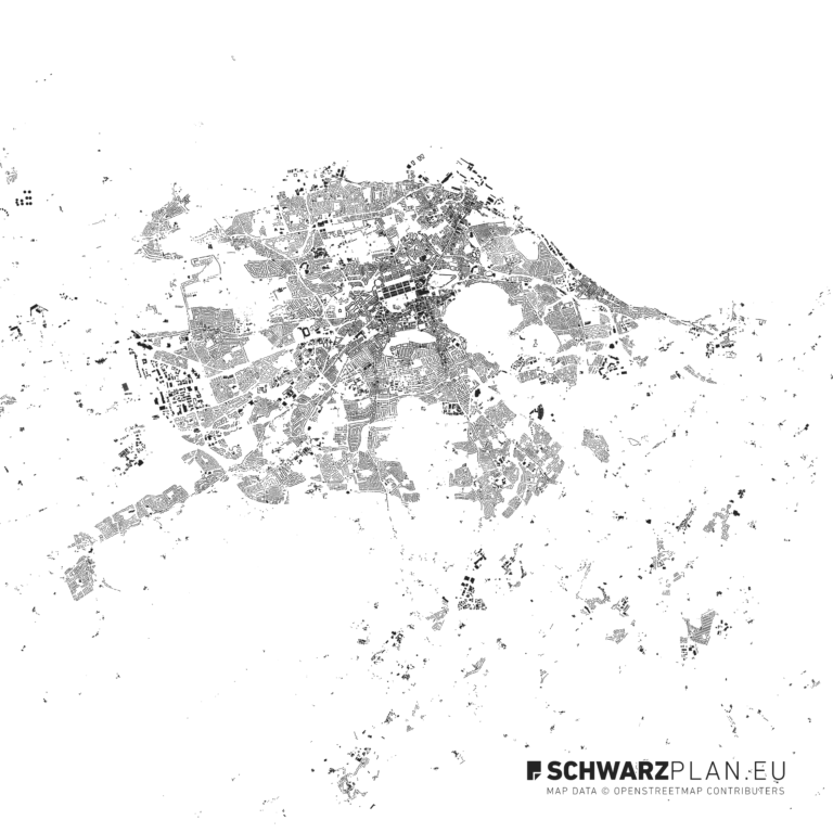
| Schwarzplan (figure-ground plan) | Planners and illustrators; not an official document. | The built structure of a city as a figure-ground plan – for design, analysis and presentation. | Explained under What are figure-ground plans? |
The one sentence on our own account: the zoning plan itself is available only from the municipality – we do not hold it and do not issue it. What we do supply is the to-scale plan base for design and presentation as PDF, DWG and DXF, and the cadastral map for orientation on the plot. Neither replaces the zoning plan or an official extract.
Related terms: What is a site plan? · What are figure-ground plans?
FAQ
Frequently asked questions about German zoning plans
Where can I view the zoning plan for my property?
What does B-Plan mean?
Is viewing a zoning plan free of charge?
What do GRZ and GFZ mean?
What applies if there is no zoning plan?
Is a zoning plan the same as a site plan?
Sources
Evidence and primary sources
- 01 BauGB §§ 8–10 (zoning plan), § 30 (admissibility), § 34 (inner area), § 35 (outer area)
- 02 Baunutzungsverordnung (BauNVO) – building area types and degree of building use
- 03 Planzeichenverordnung 1990 (PlanZV) – plan symbols and use abbreviations
- 04 IT Planning Council, resolution 2017/37 of 5 October 2017 – binding application of XPlanung and XBau
- 05 XLeitstelle XPlanung/XBau, legal notes – expiry of the five-year transition period on 8 February 2023
- 06 DiPlanung – participating states and components
- 07 Federal Statistical Office, municipality directory – 10,747 municipalities (as of 30 June 2026)
- 08 GDI Bavaria, projects – around 97,000 land-use plans in the BayernAtlas
The portal links and plan counts in the state table are individually sourced and come from the state services linked there. All sources last verified: 08/2026. Next fixed review: October 2026, not least because of Bavaria's switch to the DiPlanPortal on 31 October 2026.
More in the Catalogue
- All Site Plans & Figure-Ground Plans Shop
- Bundles & Country Packs Save
- Free Geodata & Outlines Free Tool
- View the cadastral map online – parcels & boundaries Guide
- Official site plan for a building application Guide
- Setback areas under the state building code Guide
- Site plan – basics, scale & formats Guide
Countries & Regions